UN
7 Greenham Walk
£ 310,000
Description
We don't have a Description for this property.
- Bedrooms
- 2
- Bathrooms
- 0
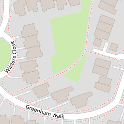


Leaflet © OpenStreetMap contributors
The heatmap indicates the level of crime in the area. The color of the heatmap indicates the crime severity and recency.
Metrics Year-on-Year
- Average area value
- 374,740.00 £Increased by 5.83 %
- Average area rental value
- 1,367.00 £/moDecreased by 6.24 %
- Est rental Yield
- 4.38 %Decreased by 11.34 %
- Crime Rate
- 2.00 %Unchanged by 0.00 %
from 354,111.00 £
from 1,458.00 £/mo
from 4.94 %
from 2.00 %
Nearby Schools
| Name | Type | Ofsted | Distance |
|---|---|---|---|
| Goldsworth Primary School | Academy Converter | 0.36 KM | |
| North West Surrey Short Stay School | Pupil Referral Unit | Good | 0.78 KM |
| The Horsell Village School | Academy Converter | 1.18 KM | |
| Horsell Village School & Sure Start Children'S Centre | Children's Centre | 1.19 KM | |
| Horsell Cofe Aided Junior School | Voluntary Aided School | Good | 1.33 KM |
Images
Nearby Streets
| Name | Average Price | Average Sqft | Distance |
|---|---|---|---|
| Julian Close | £ 0 | 0 | 0.00 KM |
| Parley Drive | £ 0 | 0 | 0.00 KM |
| Eastmead Connector | £ 0 | 0 | 0.00 KM |
| Hurst Close | £ 1,100,000 | 0 | 0.00 KM |
| Mount Hermon Road | £ 435,000 | 0 | 0.00 KM |
Nearby Transport
| Name | NLC | TLC | Distance |
|---|---|---|---|
| Woking | 5685 | WOK | 2.29 KM |
| Worplesdon | 5686 | WPL | 2.81 KM |
| Brookwood | 5687 | BKO | 6.58 KM |
| Longcross | 5674 | LNG | 8.20 KM |
| London Road (Guildford) | 5632 | LRD | 8.23 KM |
Nearby Listings
| Address | Price | Type | Score | Distance |
|---|---|---|---|---|
| Wilders Close, St. John's, Woking, Surrey, GU21 | £ 375,000 | BUY | 7 / 10 | 0.10 KM |
| ST JOHNS | £ 330,000 | BUY | 5 / 10 | 0.10 KM |
| Wilders Close, Woking, Surrey, GU21 | £ 625,000 | BUY | Unknown | 0.11 KM |
| Wilders Close, Woking, Surrey, GU21 | £ 650,000 | BUY | 6 / 10 | 0.11 KM |
| The Triangle, Woking, Surrey, GU21 | £ 525,000 | BUY | 7 / 10 | 0.22 KM |
Nearby Properties
| Address | Price | Distance |
|---|---|---|
| 5 Greenham Walk | £ 450,000 | 0.00 KM |
| 27 Greenham Walk | £ 615,000 | 0.00 KM |
| 23 Greenham Walk | £ 630,000 | 0.00 KM |
| 17 Greenham Walk | £ 442,000 | 0.00 KM |
| 1 Greenham Walk | £ 615,000 | 0.00 KM |